


For a very long time, we have overlooked the unparalleled benefits of the economic potential of the skies to boost industrial production levels. There are many factors that have restrained the growth of the drone ecosystem. The extraction of useful aerial data, the dynamic regulatory environment that constantly changes, and the absence of consistent and safe flight flow works are a few notable challenges faced by industries. Skylark Drones provides solutions to remain connected and identify the significance of aerial intelligence by altering the way industries operate.
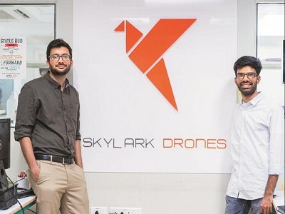
Skylark Drones was co-founded by Mrinal Pai and Mughilan Thiru Ramasamy in 2014. Skylark Drones is a start-up that opens new opportunities for businesses by changing the way aerial information is transmitted. The company has grown to serve over 100 clients to this day.
Mrinal Pai received the NASA Systems Award for his work in the UAV space, and he also co-founded Digital India for Collective Empowerment (DICE).
Paving the Way through Innovation
Skylark Drones revolutionizes and incorporates drone services and solutions into the processes involved in the real world to create more efficient benefits for various organizations and the society at large. Their technology ensures that the new processes are authentic and clear to save lives, time, and money.
There are three primary stages that are affected through drone technologies for large-scale projects, such as the construction of highways or roads, building power lines, mining, and agriculture. The primary stages are:
Planning
In this phase, the digital elevation models and survey-grade drone maps are converted into rich, high-resolution geospatial models through web-based analytical platforms. These models can be used to craft comprehensive project reports, plan important projects, and conduct a feasibility analysis.
Monitoring
Skylark Drones uses drone technology to monitor the progress of any project over time and identify any hazards or bottlenecks that may come along and require efficient management of the project. Every stakeholder has the ability to make the right decisions, regardless of the situation and Skylark’s technology nudges companies in the right direction by providing solutions that utilize real-time analysis through drone photography and videography to make better decisions.
Inspecting
Drones provide fundamental analytical information that can help business owners accurately understand the scope of maintenance or defects with other relevant information and visual evidence, such as high-quality videos, modeling tools to analyze lifecycle, thermal analysis, and pictures.
Improving Aerial Connectivity
At the moment, Skylark Drones empowers Fortune 500 companies with their drone analytics through secure execution of slights for their service providers and regulatory airspace compliance for their manufacturers. Their customer reach goes beyond industries and includes agriculture, mining, renewable energy, and infrastructure. Skylark Drones aims to provide solutions that can help sustain, plan, and build the world that we live in by increasing the scope of aerial connectivity and using drone technology to revolutionize the world.
Products and Services
Spectra
A drone-driven data program uses visual aid, such as videography, to inspect the worksite and conduct Al-powered analytics to help the construction and management teams sustain the building, construct faster, and plan better.
Drone Mission Ops (DMO)
Drone Mission Ops is a complete set of drone flight guides to enable organizations, pilots, and drone service providers to carry out unified done missions that are accurate and fast.
Drone Pass
Drone pass allows manufacturers, resellers, and system integrators to connect their drones to the Digital Sky to get clearance for drones to operate in specific areas according to the standards and protocols of the DGCA.
Industrial Sectors
Mining
Skylark Drones technology allows you to track the production and extraction volumes through Al-powered surveys. You can protect important data and measure the mining progress through various digital terrain models. In addition, you will be able to reduce material pilferage, cut down the cost of labor, maximize profitability, improve operational efficiency, and conduct quick surveys.
Spectra allows customers to manage the inventory, keep track of the assets, and measure volumes at least four times faster without stepping inside the mine. The various health risks and accidental risks associated with the terrain are eliminated. The technology will also ensure that the operations are performed at an optimum level without interruption.
Solar
Al-powered reports allow customers to monitor the construction process, acquire land through drone surveys, and maximize yield using thermal maps. You can bid for more projects and reduces the chances of obtaining false or incorrect reports by improving operational efficiency. In return, you will benefit from maximum profits and higher returns.
Drone technologies also enable you to flood-proof the area and your assets by ensuring reliance. The projects can be built faster while requiring fewer visits to the site. The visual Al suite utilizes drone maps to remotely monitor and manage the project.
Transport
Drone data solutions provided by Skylark help to end delays in construction and manage consultants through aerial maps and 3-D models. The system will enable customers to plan better and manage their construction activities remotely without worrying about delays.
Moreover, the high-resolution aerial videos will allow you to identify any gaps or deviations from the actual plan and ensure compliance.
Agriculture
The agriculture industry can benefit from maximum crop yield and enable the crops to grow better. Through high-powered drone technology, you can now monitor the health of the crop and establish control over contract farms. The results provided are accurate regardless of the location of the field or its size.
Conclusion
Skylark Drones provides skilled services for videography, inspection, mapping, and surveying for project planning, detailed analysis, and feasibility studies to provide aerial solutions to various industries.


